


Can you weigh all of the world's trees?
The world’s first satellite you probably haven’t heard of.

Sunbrella in Space
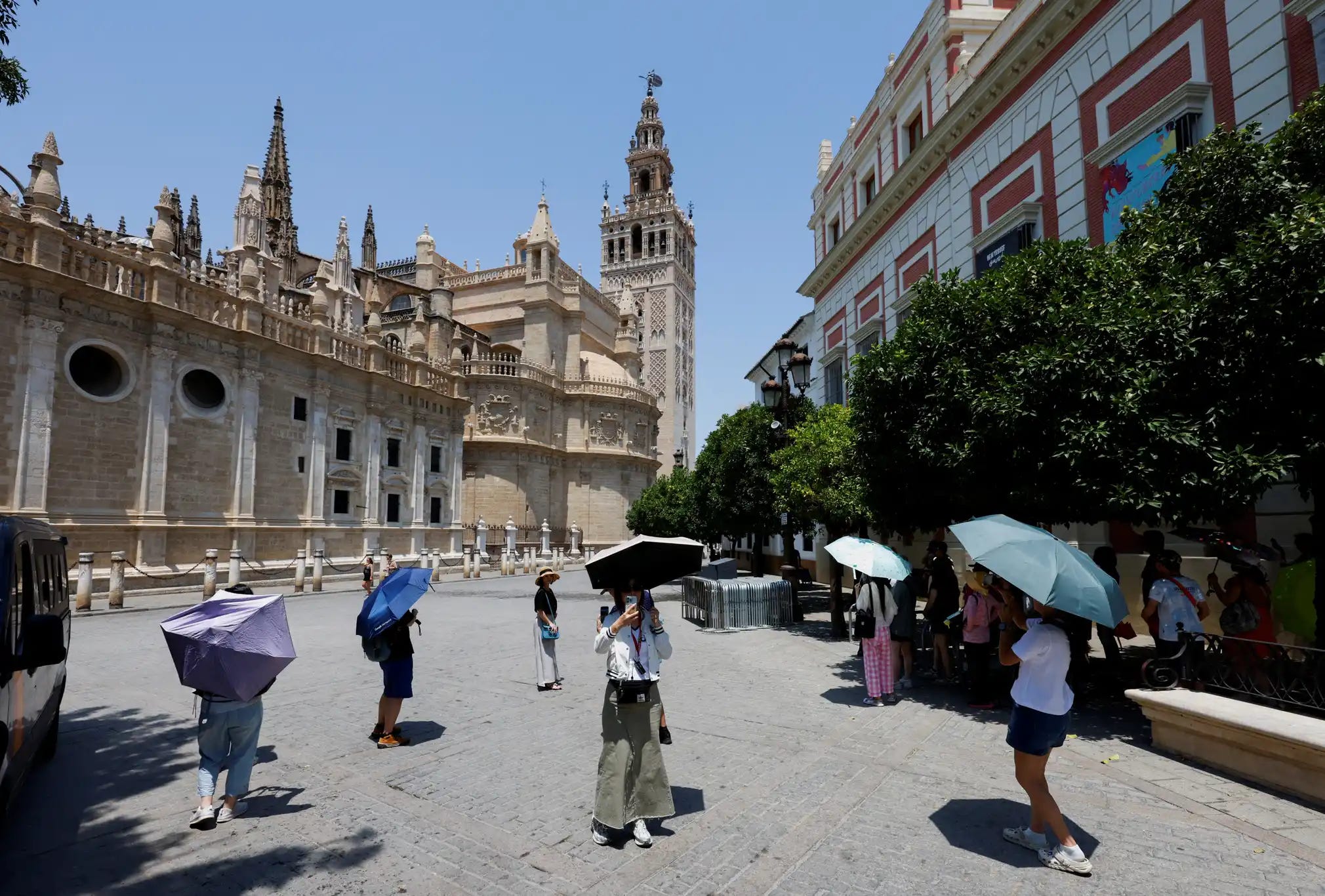
As Europe swelters under a period of intense heatwaves, people scramble for ways to cope with the new reality of tropical-like summers.
35°C in the UK. 46°C in Portugal in Spain. Insane.
Jumping into lakes, splashing yourself with fountain water, using sunbrellas…
At the same time, while the media was focused on SpaceX latest starship test resulting in a speculator explosion or the first Indian national to set foot on the ISS, a more quietly significant space mission launched into orbit on April 29th, 2025.

It’s called Biomass, and it comes with a sunbrella of its own. But instead of shielding against the effects of climate change, it’s trying to measure them.
Its mission? To gather data on the world’s forests and their woody biomass — it will literally measure the weight of all trees on the planet.
Crazy, right?
And before you think to yourself: “why on Earth do we need to know that?”
Let me explain.
Carbon sinks
Carbon sinks are natural systems that absorb and store carbon dioxide (CO₂) from the atmosphere, helping to regulate Earth’s climate by reducing greenhouse gases.
In total, natural sinks (land + ocean) absorb ~50–55% of human CO₂ emissions annually. The remaining ~45% stays in the atmosphere, driving global warming.
There’s growing research into how these sinks function, how effective they are, and whether they’re nearing any tipping points.
Oceans, vast as they are, are surprisingly better understood. But forests — and trees specifically — remain more mysterious. They’re notoriously difficult to quantify: their numbers constantly shift due to deforestation, wildfires, and reforestation. But more critically, they’ve been nearly impossible to measure from above — all because of leaves.
Most of the carbon is stored in a tree’s trunk and branches, but satellites haven’t been able to “see” them — their view is blocked by the canopy.
That’s where the Biomass mission comes in.
A collaboration of 50+ teams across 20 European countries resulted in a one-of-a-kind satellite capable of seeing through trees to measure their woody biomass.
It tracks how much carbon forests absorb or release over time. This data will feed directly into climate models, improve carbon accounting, and inform forest conservation policies worldwide.
How is this even possible?
The key to this breakthrough lies in a 70 cm wavelength P-band synthetic aperture radar paired with a 12-meter-wide deployable reflector antenna — a giant, golden “sunbrella.”
Since most leaves and smaller plant material are under 70 cm in size, the radar waves pass through the canopy and bounce back from the larger, carbon-rich structures: the trunks and branches.

According to ESA, this long wavelength can even penetrate dry sand up to five meters deep, allowing us to map subsurface geological features like ancient riverbeds and lake basins — offering glimpses into past climate systems..
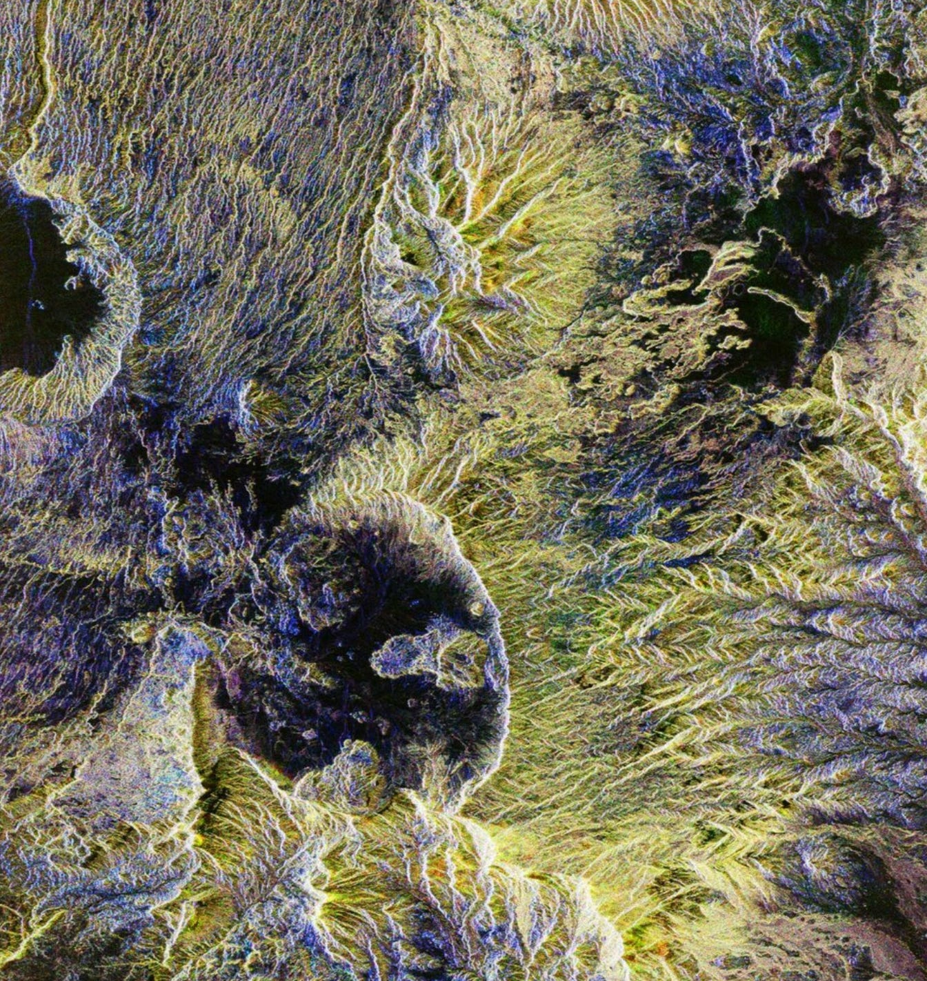
The first results are in!
Just two months after launch, Biomass has started sending back its first visuals — and they’re mesmerizing.

Unlike traditional satellite imagery, these visuals are color-coded using the instrument’s polarization channels, each color revealing distinct surface characteristics:
Green: rainforests
Red: forested floodplains
Blue-purple: grasslands
Black: rivers and lakes
Even deserts benefit. Thanks to its sand-penetrating radar, Biomass reveals fossil water sources in arid regions — a powerful tool for regions facing extreme water scarcity.
Scale in the sky
As the planet faces the growing impacts of climate change, it’s become essential to deepen our understanding of both the forces driving it and the natural systems working to keep it in balance.
With Biomass and its golden “sunbrella” now in orbit, we’ll gain unprecedented insights into how forests function as carbon sinks — and how that role evolves over time. This knowledge will hopefully pave the way for more data-driven decisions and smarter climate policies in the years ahead.
Hopefully.